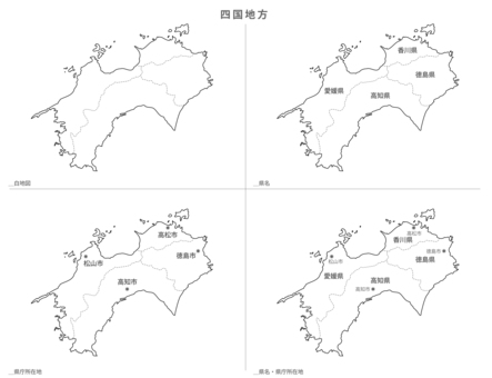
![Blank Map-Japan-Shikoku Region Set, JPG, PNG and EPS Blank Map-Japan-Shikoku Region Set, , JPG, PNG and EPS](https://thumb.ac-illust.com/65/651324db60aee79e7b09acb620922ae5_t.jpeg)
Blank Map-Japan-Shikoku Region Set
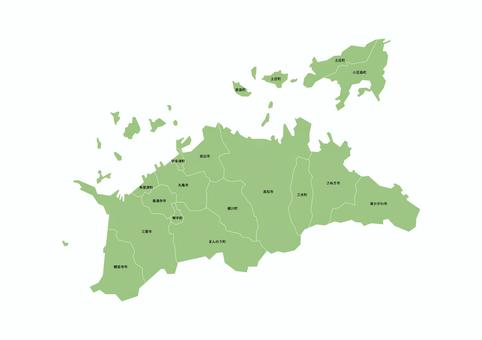
![Blank Map-Japan-Entering Districts, Towns and Villages_Kagawa Prefecture, JPG, PNG and EPS Blank Map-Japan-Entering Districts, Towns and Villages_Kagawa Prefecture, , JPG, PNG and EPS](https://thumb.ac-illust.com/2e/2eb1ba44e738aa55a9bfaf0d38e612f2_t.jpeg)
Blank Map-Japan-Entering Districts, Towns and Villages_Kagawa Prefecture
![Deformed map with municipalities_Tokushima 01, JPG and PNG Deformed map with municipalities_Tokushima 01, , JPG and PNG](https://thumb.ac-illust.com/4f/4ffc8721508ce6318c46a3856133da61_t.jpeg)
Deformed map with municipalities_Tokushima 01
![Deformed map with municipalities_Kagawa 01, JPG, PNG and EPS Deformed map with municipalities_Kagawa 01, , JPG, PNG and EPS](https://thumb.ac-illust.com/ff/ff83671d338b2dfdecef0d9844033244_t.jpeg)
Deformed map with municipalities_Kagawa 01
![Design map_Ehime prefecture-curve, JPG, PNG and EPS Design map_Ehime prefecture-curve, , JPG, PNG and EPS](https://thumb.ac-illust.com/b8/b881b215bfab271fb9a4beb63f2e1a87_t.jpeg)
Design map_Ehime prefecture-curve
![Design Map_Kochi Prefecture-Illustration, JPG, PNG and EPS Design Map_Kochi Prefecture-Illustration, , JPG, PNG and EPS](https://thumb.ac-illust.com/cf/cfb921dfd7076c2c91ebbfdebaeba34d_t.jpeg)
Design Map_Kochi Prefecture-Illustration
![Municipality map_Kagawa prefecture_Deformation-09, JPG, PNG and EPS Municipality map_Kagawa prefecture_Deformation-09, , JPG, PNG and EPS](https://thumb.ac-illust.com/83/83965a83122e8f4ca97a26f3609c8dfa_t.jpeg)
Municipality map_Kagawa prefecture_Deformation-09
![Municipality map_Kagawa prefecture_Deformation-02, JPG, PNG and EPS Municipality map_Kagawa prefecture_Deformation-02, , JPG, PNG and EPS](https://thumb.ac-illust.com/93/9384a78d1145ead01410d3137dd14c46_t.jpeg)
Municipality map_Kagawa prefecture_Deformation-02
![Municipality map_Kagawa prefecture_Deformation-03, JPG, PNG and EPS Municipality map_Kagawa prefecture_Deformation-03, , JPG, PNG and EPS](https://thumb.ac-illust.com/47/477927fbef381bea6d32611beb4d4979_t.jpeg)
Municipality map_Kagawa prefecture_Deformation-03
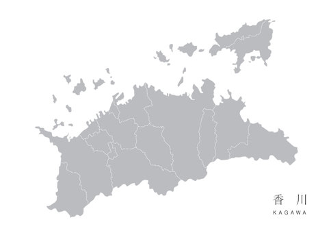
![Modern map of Kagawa prefecture with administrative divisions (silver-gray), JPG, PNG and AI Modern map of Kagawa prefecture with administrative divisions (silver-gray), , JPG, PNG and AI](https://thumb.ac-illust.com/af/af6ee7d90e76af4a5ccd399515a6b9af_t.jpeg)
Modern map of Kagawa prefecture with administrative divisions (silver-gray)
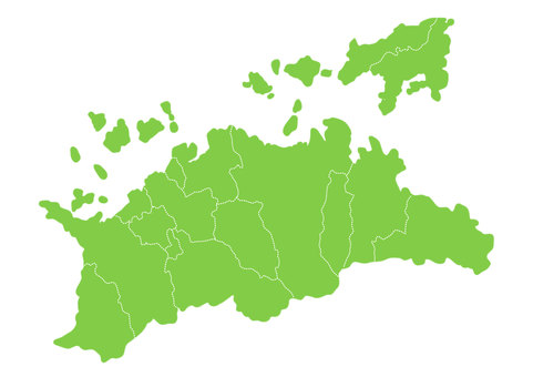
![A fluffy map of Kagawa prefecture with administrative divisions, JPG, PNG and AI A fluffy map of Kagawa prefecture with administrative divisions, , JPG, PNG and AI](https://thumb.ac-illust.com/c4/c43534cb06aba595744cb0b0310de4bc_t.jpeg)
A fluffy map of Kagawa prefecture with administrative divisions
![Kagawa Prefecture, JPG and AI Kagawa Prefecture, , JPG and AI](https://thumb.ac-illust.com/0c/0c3eaaae49d83f0af4e9542e266fae3d_t.jpeg)
Kagawa Prefecture
![Map of Kagawa Prefecture Entering the name of the municipality, JPG, PNG and AI Map of Kagawa Prefecture Entering the name of the municipality, , JPG, PNG and AI](https://thumb.ac-illust.com/f6/f6cebda4f15f4b7d3acf6febddee1a76_t.jpeg)
Map of Kagawa Prefecture Entering the name of the municipality
![Kagawa Prefecture, JPG and PNG Kagawa Prefecture, , JPG and PNG](https://thumb.ac-illust.com/db/db90ef0fcb0d171ad3dabea6be38813b_t.jpeg)
Kagawa Prefecture
![シンプルな香川県の地形, JPG, PNG and AI シンプルな香川県の地形, , JPG, PNG and AI](https://thumb.ac-illust.com/06/06629dd8045865803f7aaaba2191d276_t.jpeg)
シンプルな香川県の地形
![Map of cities, towns and villages in Kagawa Prefecture, JPG, PNG and AI Map of cities, towns and villages in Kagawa Prefecture, , JPG, PNG and AI](https://thumb.ac-illust.com/f4/f467b2b7adf7d3182af785411766389d_t.jpeg)
Map of cities, towns and villages in Kagawa Prefecture
![Kagawa Prefecture, JPG and PNG Kagawa Prefecture, , JPG and PNG](https://thumb.ac-illust.com/70/70ebdfbf5b83f2760f0f9667eb63b576_t.jpeg)
Kagawa Prefecture
![Old map_Shikoku region, JPG, PNG and AI Old map_Shikoku region, , JPG, PNG and AI](https://thumb.ac-illust.com/b5/b58189ac71328c20ed9eab15414e2958_t.jpeg)
Old map_Shikoku region
![松山市:地方地図, JPG and PNG 松山市:地方地図, , JPG and PNG](https://thumb.ac-illust.com/93/939961434de02085a25b45c5ab2281c6_t.jpeg)
松山市:地方地図
![Shikoku map, JPG, PNG and AI Shikoku map, , JPG, PNG and AI](https://thumb.ac-illust.com/23/23aa411905d2ba2daf7617bcff6de532_t.jpeg)
Shikoku map
![Map of major roads in Takamatsu City, Kagawa Prefecture, Shikoku, JPG, PNG and AI Map of major roads in Takamatsu City, Kagawa Prefecture, Shikoku, , JPG, PNG and AI](https://thumb.ac-illust.com/38/384cab0af175d9b7b8571b8a97cb1a04_t.jpeg)
Map of major roads in Takamatsu City, Kagawa Prefecture, Shikoku
![Takamatsu City, Kagawa Prefecture, JPG, PNG and AI Takamatsu City, Kagawa Prefecture, , JPG, PNG and AI](https://thumb.ac-illust.com/18/18a54d567948766520074b34d04696f6_t.jpeg)
Takamatsu City, Kagawa Prefecture
![Japan regional division _ Shikoku _ prefectural office location Kana attached gy, JPG, PNG and EPS Japan regional division _ Shikoku _ prefectural office location Kana attached gy, , JPG, PNG and EPS](https://thumb.ac-illust.com/75/75c1a7877bc7d484140319ffc9d7e0e7_t.jpeg)
Japan regional division _ Shikoku _ prefectural office location Kana attached gy
![Japan regional division _ Shikoku _ prefectural office location with kana bk, JPG, PNG and EPS Japan regional division _ Shikoku _ prefectural office location with kana bk, , JPG, PNG and EPS](https://thumb.ac-illust.com/63/6320e750a42f014d7e1b010580b1ac02_t.jpeg)
Japan regional division _ Shikoku _ prefectural office location with kana bk
![Japan regional division _ Shikoku _ plain _ gry, JPG, PNG and EPS Japan regional division _ Shikoku _ plain _ gry, , JPG, PNG and EPS](https://thumb.ac-illust.com/43/435ecfdf0eadebcc83dff793a92063bf_t.jpeg)
Japan regional division _ Shikoku _ plain _ gry
![Map of Kagawa prefecture, JPG and AI Map of Kagawa prefecture, , JPG and AI](https://thumb.ac-illust.com/50/504a209ec7c40265814d79b666ebc3db_t.jpeg)
Map of Kagawa prefecture
![Prefectural capital, Takamatsu City, Kagawa Prefecture, JPG and AI Prefectural capital, Takamatsu City, Kagawa Prefecture, , JPG and AI](https://thumb.ac-illust.com/82/821e685990f01a39bfe209cf4c2074b9_t.jpeg)
Prefectural capital, Takamatsu City, Kagawa Prefecture
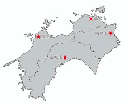
![Japan regional division _Shikoku_prefectural office location_gry, JPG, PNG and EPS Japan regional division _Shikoku_prefectural office location_gry, , JPG, PNG and EPS](https://thumb.ac-illust.com/83/83c102216513670d9a3c65cc21d405fb_t.jpeg)
Japan regional division _Shikoku_prefectural office location_gry
![Japan region division _ Shikoku _ prefecture name entered _ gry, JPG, PNG and EPS Japan region division _ Shikoku _ prefecture name entered _ gry, , JPG, PNG and EPS](https://thumb.ac-illust.com/00/00b3fff5ad16410319e7d0ffdc629c5a_t.jpeg)
Japan region division _ Shikoku _ prefecture name entered _ gry
![Japan regional division _Shikoku_prefecture border _gry, JPG, PNG and EPS Japan regional division _Shikoku_prefecture border _gry, , JPG, PNG and EPS](https://thumb.ac-illust.com/57/57da0eee516611466430c316864cefb5_t.jpeg)
Japan regional division _Shikoku_prefecture border _gry
![Japan region division _ Shikoku _ prefecture name entered _ bk, JPG, PNG and EPS Japan region division _ Shikoku _ prefecture name entered _ bk, , JPG, PNG and EPS](https://thumb.ac-illust.com/a0/a0d8580294efb40ba335f45c37dd9768_t.jpeg)
Japan region division _ Shikoku _ prefecture name entered _ bk
![Japan regional division _ China _ prefecture boundary _ bk, JPG, PNG and EPS Japan regional division _ China _ prefecture boundary _ bk, , JPG, PNG and EPS](https://thumb.ac-illust.com/58/58aac65843476b82526d2c42e264234f_t.jpeg)
Japan regional division _ China _ prefecture boundary _ bk
![Takamatsu city, Kagawa prefecture map illustration, JPG and PNG Takamatsu city, Kagawa prefecture map illustration, , JPG and PNG](https://thumb.ac-illust.com/42/424092553492e0eb3b4c1d979981c674_t.jpeg)
Takamatsu city, Kagawa prefecture map illustration
![Japan region division _ Shikoku _ English prefecture name entered _ bk, JPG, PNG and EPS Japan region division _ Shikoku _ English prefecture name entered _ bk, , JPG, PNG and EPS](https://thumb.ac-illust.com/7d/7d97ee52a9adcef5d847bedc735e491a_t.jpeg)
Japan region division _ Shikoku _ English prefecture name entered _ bk
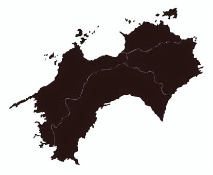
![Japan regional division _Shikoku_prefecture boundary line_bk, JPG, PNG and EPS Japan regional division _Shikoku_prefecture boundary line_bk, , JPG, PNG and EPS](https://thumb.ac-illust.com/23/2350e0d9ec6261266d1967e52eaeec5c_t.jpeg)
Japan regional division _Shikoku_prefecture boundary line_bk
![Japan region division _ Shikoku _ English prefecture name entered _ gry, JPG, PNG and EPS Japan region division _ Shikoku _ English prefecture name entered _ gry, , JPG, PNG and EPS](https://thumb.ac-illust.com/0e/0e28d93be5623d63d086dc3d97851096_t.jpeg)
Japan region division _ Shikoku _ English prefecture name entered _ gry
![At Ritsurin Garden (Kagawa Prefecture), JPG At Ritsurin Garden (Kagawa Prefecture), , JPG](https://thumb.ac-illust.com/49/49eb33ce309fc1e6942aeaf3f74abcd5_t.jpeg)
At Ritsurin Garden (Kagawa Prefecture)
![Takamatsu City, Kagawa Prefecture, JPG and PNG Takamatsu City, Kagawa Prefecture, , JPG and PNG](https://thumb.ac-illust.com/49/490329797bbaca99209931cb14054fbe_t.jpeg)
Takamatsu City, Kagawa Prefecture
![Takamatsu City, Kagawa Prefecture Prefectural Office Location Over the border, JPG and AI Takamatsu City, Kagawa Prefecture Prefectural Office Location Over the border, , JPG and AI](https://thumb.ac-illust.com/2d/2de4117f98a131580b305d8e49b7105b_t.jpeg)
Takamatsu City, Kagawa Prefecture Prefectural Office Location Over the border
![Japan regional division _ Shikoku _ prefectural office location _ bk, JPG, PNG and EPS Japan regional division _ Shikoku _ prefectural office location _ bk, , JPG, PNG and EPS](https://thumb.ac-illust.com/91/91d6657a1c491b4c09ac701d11d788d8_t.jpeg)
Japan regional division _ Shikoku _ prefectural office location _ bk
![Kagawa Prefecture prefectural capital location map, JPG and PNG Kagawa Prefecture prefectural capital location map, , JPG and PNG](https://thumb.ac-illust.com/01/01db7856dd9bdc48c9f4d23f9c114316_t.jpeg)
Kagawa Prefecture prefectural capital location map
![Prefectural capital map, JPG, PNG and AI Prefectural capital map, , JPG, PNG and AI](https://thumb.ac-illust.com/8c/8cc9bbaf3b46f60e554b5a51e592f055_t.jpeg)
Prefectural capital map
![Kagawa prefecture capital location map, JPG, PNG and AI Kagawa prefecture capital location map, , JPG, PNG and AI](https://thumb.ac-illust.com/f9/f9ab8a06b4127481bf5c83d4e9e3660a_t.jpeg)
Kagawa prefecture capital location map
![Kagawa prefecture map light blue illustration, JPG, PNG and AI Kagawa prefecture map light blue illustration, , JPG, PNG and AI](https://thumb.ac-illust.com/06/0616d78c9fff7376bf509bb7fa89e4c1_t.jpeg)
Kagawa prefecture map light blue illustration
![Kagawa prefecture map green illustration, JPG, PNG and AI Kagawa prefecture map green illustration, , JPG, PNG and AI](https://thumb.ac-illust.com/11/114f97a3349231ac49de48019deb3157_t.jpeg)
Kagawa prefecture map green illustration
![Kagawa prefecture map green illustration, JPG, PNG and AI Kagawa prefecture map green illustration, , JPG, PNG and AI](https://thumb.ac-illust.com/c2/c2d25054e67943caf667b43e8c3899ce_t.jpeg)
Kagawa prefecture map green illustration
46 Klip klip vektor gratis babagan .
Need vector clip art? Temokake babagan free stock gratis babagan .
Kabeh vector clip art gratis kanggo proyek komersial.
Need vector clip art? Temokake babagan free stock gratis babagan .
Kabeh vector clip art gratis kanggo proyek komersial.